Bradfield Metro Link Road
Consultation has concluded
It’s proposed that Bradfield Metro Link Road will provide a loop connecting Badgerys Creek Road, Eastern Ring Road and Fifteenth Avenue (West). It will be a key road link for the new Metro Station at Bradfield Centre including a bus interchange and supporting bus services.
The corridor will play a critical role by linking three key corridors in the Western Sydney International Airport Precinct to connect with public and green space, and community facilities, as well as walking precincts for Bradfield’s main streets.
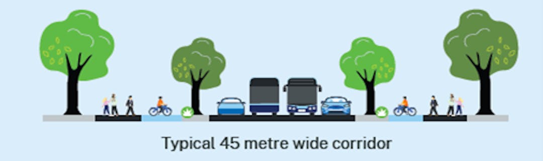
The road corridor design is 45m wide.
Key facts - proposed future corridor use
Corridor | Scope |
Function | City serving |
Length of road | 3km |
Lanes | Four lane (two buses, two general traffic lanes) divided carriageway between Badgerys Creek Road and Eastern Ring Road |
Corridor width | 45m |
Intersections and type | Five traffic light intersections |
Public transport infrastructure | Dedicated bus lane in each direction |
Active transport infrastructure | Separated walking and bike riding path on each side of the road |
Amenity improvements | Kerb-side tree canopy |
Access from driveways | No restriction |
Primary movement | Buses, local vehicle access, walking and bike riding |
Other movement | Buses, general vehicles, heavy vehicle access along the corridor |