Devonshire Road
Devonshire Road provides a key north-south connection for the Western Sydney International Airport Precinct connecting Bringelly Road, Fifteenth Avenue West and Elizabeth Drive.
This will enable connectivity for the Western Sydney International Airport Precinct Core to Bringelly and Camden Valley Way in the south, and in the north will connect to Kemps Creek, and potential urban growth areas located west of the M7 Motorway at Horsley Park and Mount Vernon.
This north-south connection will also be a key corridor for the Mamre Road Precinct which hosts the Western Sydney Employment Area (WSEA) and future freight intermodal terminal (IMT).
Connections to Elizabeth Drive will enable access to Sydney’s motorway network near the M12/M7 interchange.
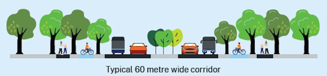
The road corridor design is 60m wide.
Key facts - proposed future corridor use
Corridor | Scope |
Function | City serving |
Length of road | 9.1km upgrade:
|
Lanes | Four – two in each direction with provision for a third lane in each direction, including 100m long twin bridges over the Tributary North of Wynyard Avenue |
Corridor width | 60m |
Intersections and type | 22 intersections, six with traffic lights |
Public transport infrastructure | Bus only lane, in addition to bus capable lanes in each direction where required |
Active transport infrastructure | Separated walking and bike riding path on each side |
Amenity improvements | Kerb-side tree canopy |
Access from driveways | Controlled |
Primary movement | Freight vehicles along the corridor |
Other movement | General vehicles, bus, and walking and bike riding paths |
Interdependencies | Potential traffic light intersection at Lawson Road |